To provide resilient and sustainable mobility citywide, develop a comprehensive bus rapid transit system to support the “last-mile commute” for areas not well-covered by the subway.
By Aditya Bhagath, Adriana Chávez, Liam Cutri-French, William Farrell, Thomas Heltzel, Nicole Payne, Danny Pearlstein, Niharika Shekhawat, Ria Singh, Michael Woods
The Need
New York City must urgently address the need for resilient and reliable transit solutions as extreme weather events become more frequent due to the climate crisis. Despite having one of the most extensive transit systems in the country, New York City’s commutes are highly vulnerable to disruptions. Rainstorms, flooding, and heatwaves expose the fragility of the city’s transit infrastructure, often leading to significant delays or making travel dangerous. Flooding and extreme heat can even shut down the system entirely. During peak times, subway platforms can become up to 20°F hotter than the outside temperature, creating severe public health risks, especially when trains are crowded.
Even under normal conditions, New York’s transit system struggles with interborough connections. Delays impact commuters heading to work, appointments, or just visiting family and friends. To improve reliability and access, New York City must focus on areas with the weakest transit connections and where New Yorkers endure the most difficult commutes. Healthcare workers, in particular, face some of the worst commutes citywide. Unlike many other sectors of the city’s economy, healthcare jobs are not concentrated in Manhattan’s central business districts; in fact, approximately 65% of all healthcare jobs are located in the boroughs outside Manhattan.(1)

Looking to past transportation measures, the City’s response during Hurricane Sandy highlights the crucial role of surface transit – specifically buses – in providing resilient transit. The storm affected 11 million daily travelers, damaging over 500 miles of roads and shutting down the subway for days. In response, the City implemented single-occupant vehicle restrictions and successful “bus bridges” that allowed over 226,000 commuters to cross the East River – nearly triple the usual bus riders. (2)
New Yorkers deserve reliable ways to reach not only their usual subway stations but also to access other lines and destinations directly. Establishing fast, frequent, and reliable surface transit corridors is crucial for building a transportation network resilient to both everyday disruptions and long-term climate change-induced threats.
The Vision
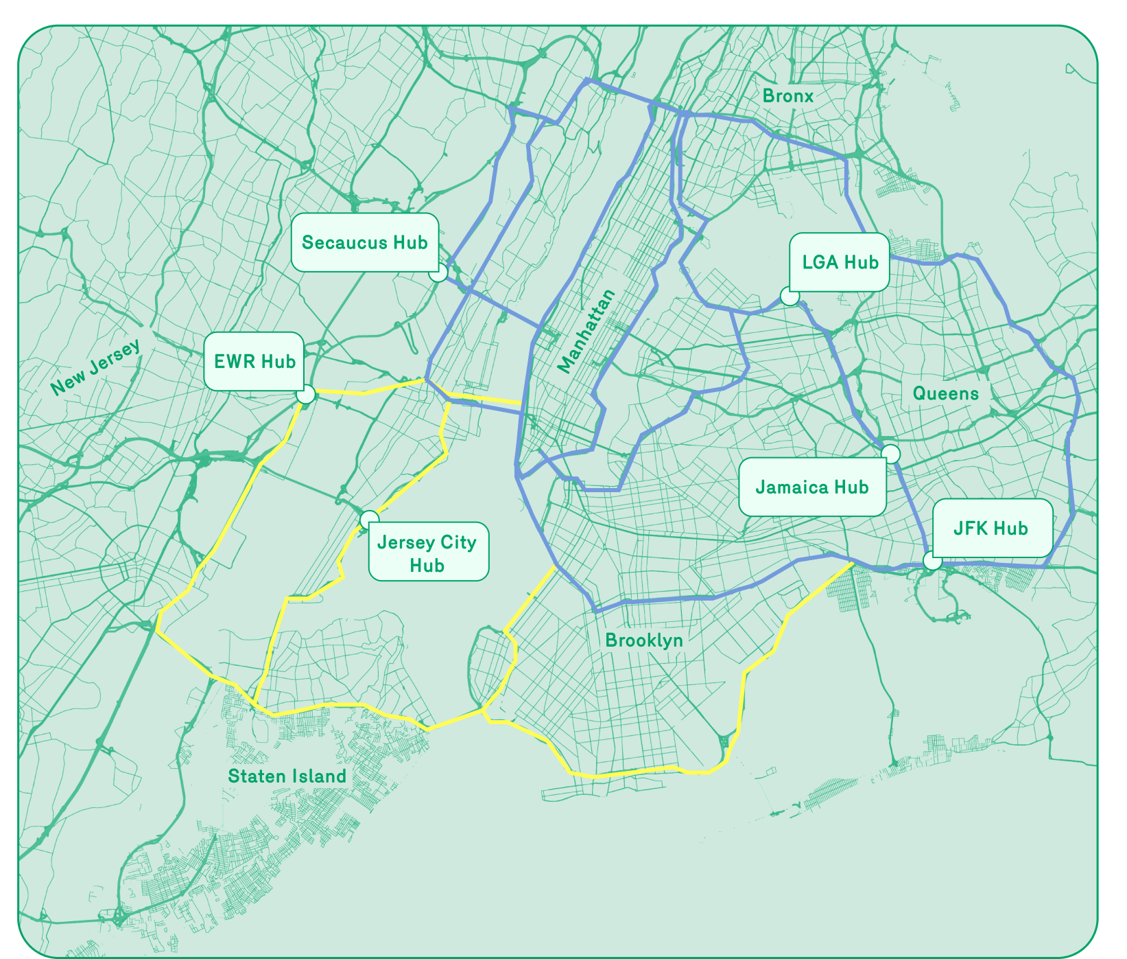
To provide resilient, low-to-zero-carbon connections citywide, New York City could develop a comprehensive bus rapid transit (BRT) system to support the “last-mile commute.” These new connections would serve areas not well-covered by the subway, creating stronger links to existing transit. Large-scale BRT deployment could create continuous loops around New York, alongside localized street and intersection redesigns to de-prioritize car traffic. This expanded network would align with local climate initiatives, including the MTA’s $6 billion climate resilience roadmap.
To implement large-scale BRT, a coalition of city and state agencies, including NYC and NYS Departments of Transportation, Metropolitan Transportation Authority (MTA), NJ Transit, and Port Authority of New York and New Jersey (PANYNJ), could be formed. Task forces would determine bus selection, lane corridors, and transit hub designs.
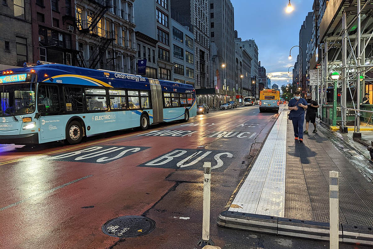
The plan could begin with immediate, low-cost BRT implementation on arterial roads and highways using temporary methods such as paint and plastic barriers. This system will connect major transit hubs and bypass Manhattan’s Central Business District, focusing on New York City’s five boroughs and parts of Northern New Jersey. Over the next 1-5 years, more significant investments will be needed to improve the BRT system’s infrastructure, including bus terminals, depots, concrete lane separation, and workforce enhancements.
In 5-20 years, as demand increases, BRT could transition to rail systems to accommodate higher capacity. Vacated BRT lanes could be repurposed for public uses such as parks, bike lanes or green infrastructure. Beyond 20 years, BRT investment, rail transition, and right-of-way reuse should be continued. The transit system could be expanded to outer suburban areas, reducing reliance on private vehicles and shaping an efficient, equitable regional transportation network.
To carry out the design of a new comprehensive bus rapid transit system, the City could develop street redesigns at three different scales: citywide, along major corridors, and at intersections. In addition, various funding and communication strategies could help carry out implementation.
→
Establish a network that links a system of corridors and intermodal connections.
- Incorporate Bus Rapid Transit Design Standard in the planning of the new network.
- The MTA and DOT should collaborate to define a bus rapid transit strategy to connect major job centers, like healthcare institutions, and major transportation hubs.
- Design a network of intersecting bus corridors in a grid-like system that allow for reliable transfers and system resilience.
→
Configure corridors as linear extensions of existing subway transit to service the “last mile commute.”
- Improve bus frequency and service by expanding dedicated bus lanes.
- Space bus stops every 10 blocks to mimic subway frequency and maintain optimal service.
- Improve ridership experience along corridors by transforming right-of-way to incorporate street trees, linear parks, and pedestrian priority interventions.
→
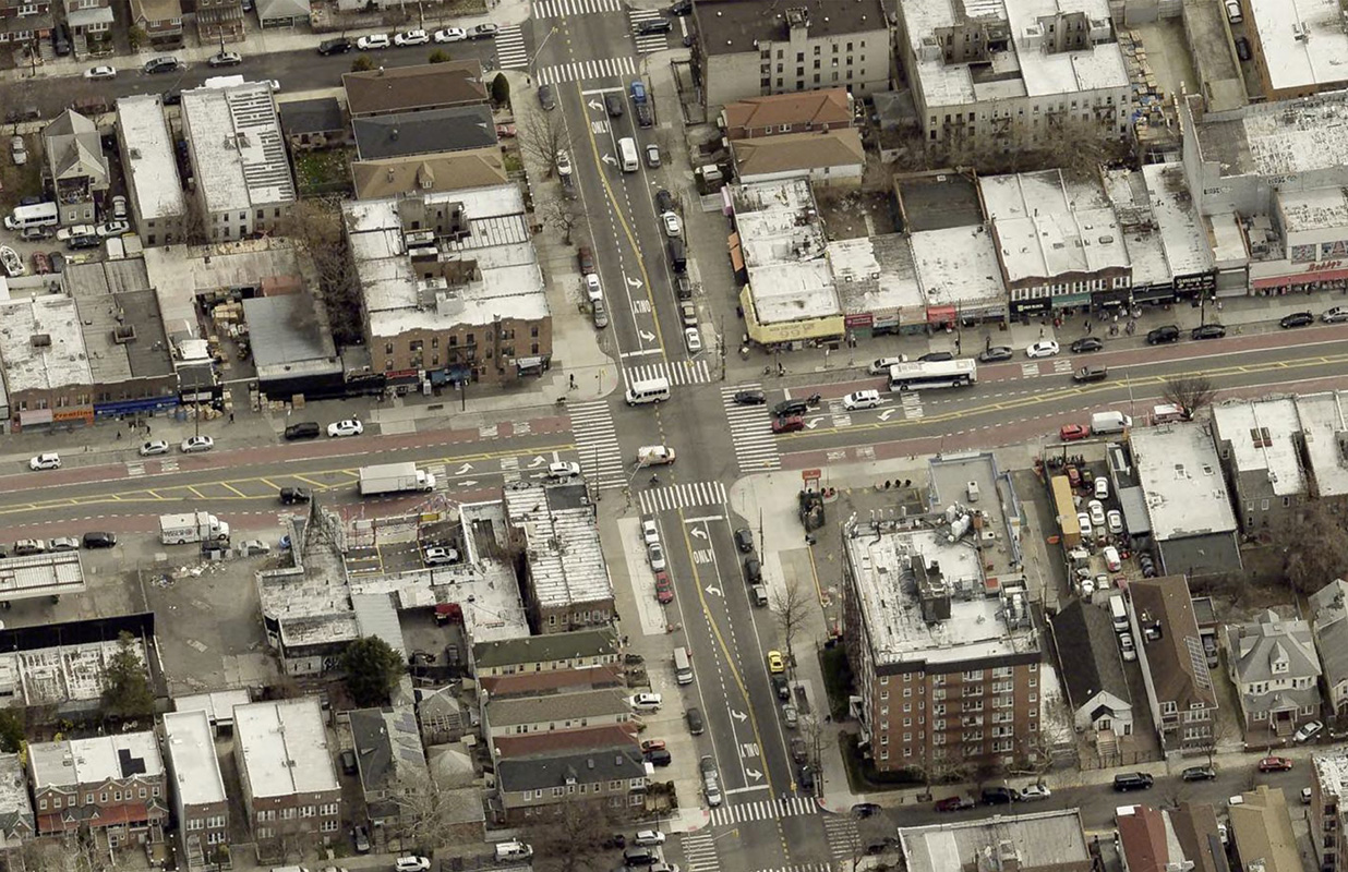
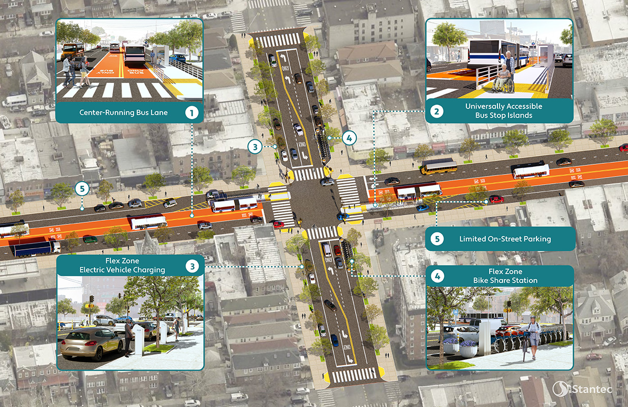
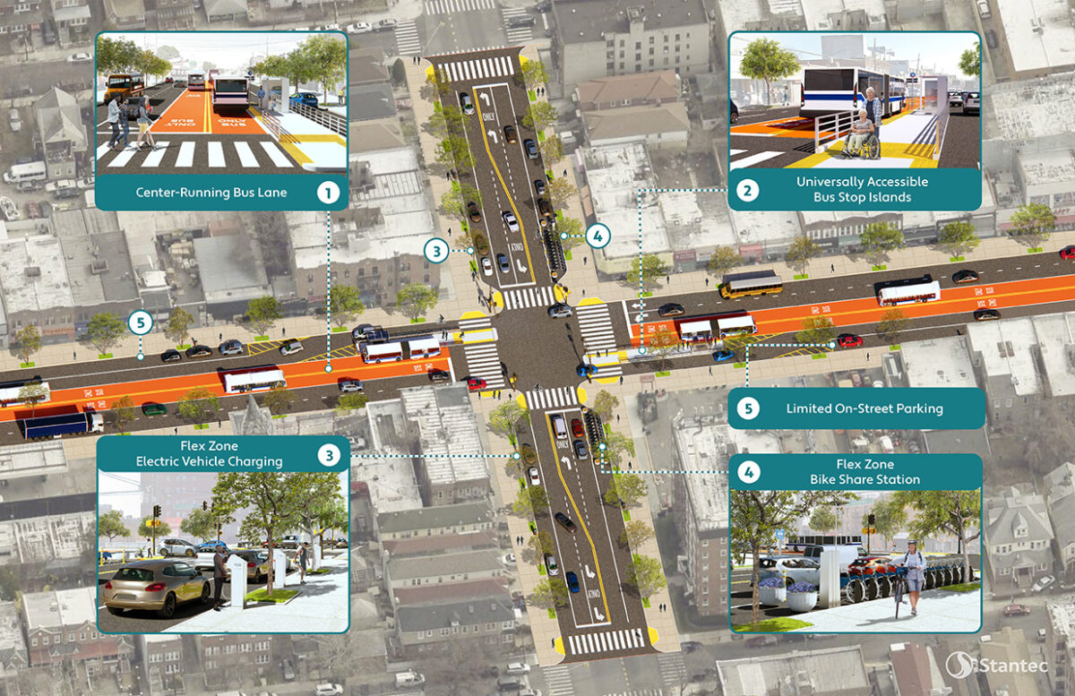
Redesign key intersections to reduce traffic congestion and improve access to center running bus lanes.
- Bus stops could be built up for platform level onboarding and offboarding of MTA buses.
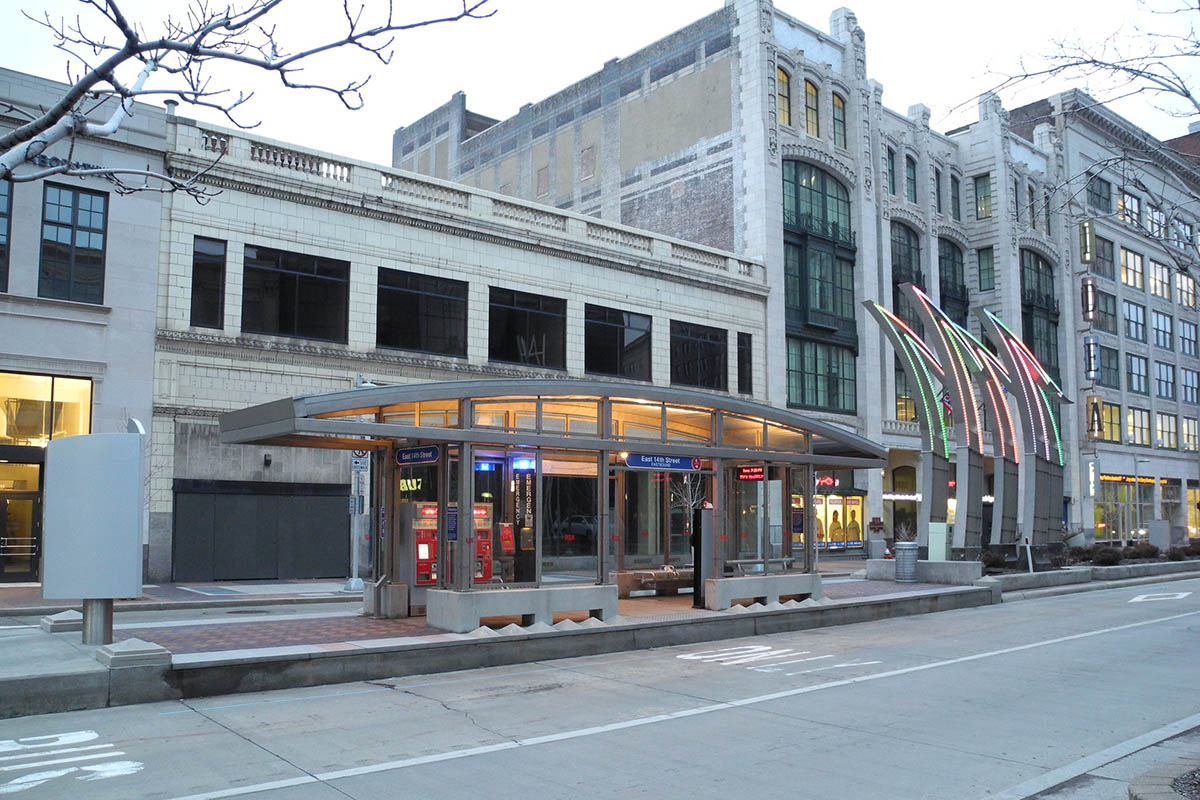
- Bus stops and shelters could deploy climate resilience design tools like shade structures, cool pavements and roofs, and nature-based solutions for flood management and improve thermal comfort.
- Bus platforms could integrate supporting infrastructure for low-carbon or electric buses with rapid charging stations.
- With bus lanes center running, cross streets could incorporate a “flex zone” at certain distances from the crosswalk and host special features that could be allocated to: pedestrian safety through daylighting, pick-up/drop-off and commercial loading/unloading locations, and waste containerization.
→
Shape effective communication and advocacy to garner political and grassroots support of bus priority projects. Key messaging themes could include:
- Transit Options: Invest in reliable bus systems that extend beyond the subway for more transit options.
- Climate Resilience: Utilize BRT corridors as essential transportation networks during extreme weather.
- Job Access: Enhance connectivity outside central business districts to reduce commute times and increase job access.
- Essential Workers: Address the transit needs of healthcare workers to benefit all New Yorkers.
→
Explore a variety of funding pathways by leveraging the diverse stakeholders at the table.
- MTA-led funding with MOUs (Memorandum of Understanding) with stakeholders like NYC DOT, PANYNJ, NY State DOT, and New Jersey municipalities.
- USDOT and FTA grant funding with local matching funds in both New York and New Jersey.
- Value capture around new transit hubs in Brooklyn, Queens, Staten Island, and New Jersey through property and economic development.
Act Now
To test this proposal in the short term, a corridor could be piloted to deploy interventions that improve and prioritize bus services and pedestrian access. To demonstrate opportunities and network resilience between the subway and bus networks, the pilot corridor could begin where the 2 and 5 trains intersect with Utica Avenue, continuing with improvements at the following intersections: Utica Ave x Empire Blvd x E New York Ave, Utica Ave x Linden Blvd, and Flatbush Ave x Church Ave.
At these locations, relatively low-cost interventions such as paint and signage could be used to prioritize bus services, improve pedestrian and bike safety, and enhance flex zone usage on side streets. Additionally, investments could be made in bus shelters and stop improvements along Utica Ave to increase visibility, protection, and accessibility for riders.
Each of these intersections connects with numerous bus lines, making them strategic nodes for improvement. Therefore, supporting enhancements at these locations will increase the reliability and resilience of the broader transit network, ensuring smoother transfers and better accessibility for riders.
To measure the success of the pilot, the following metrics could be used:
- Bus speeds
- Ridership numbers
- Surrounding business and economic growth
- Reduced commute times
- Decreased surface temperatures
- Reliability and wait times during both normal and inclement weather
Case Studies
| PROJECT | OVERVIEW | IMPACT | RELEVANCE |
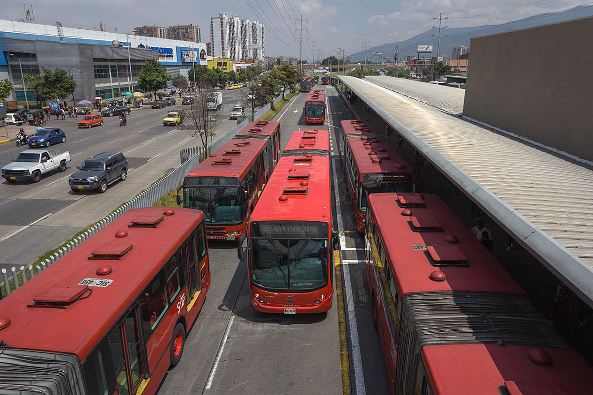
| Cleveland’s Healthline | Cleveland’s first Bus Rapid Transit (BRT) system connects Downtown and University Circle via the Euclid corridor. Spanning 7.1 miles, it operates 24/7 with 10-minute peak service and features 63-foot hybrid electric vehicles.(3) | Boasts the highest ROI of any U.S. transit project, generating $9.5 billion in economic development. Ridership surged by 48% in the first year, with travel times reduced from 46 to 34 minutes. | New York City can use this model to create BRT corridors connecting key employment centers, improving transit efficiency and economic growth, with a focus on healthcare commutes. |
| Bogotá’s TransMilenio | Bogotá’s TransMilenio BRT system replaced an inefficient transport network with a sustainable alternative, funded by public-private partnerships. It started with 42 km of routes, expanding to 388 km by 2024. | Improved fuel efficiency, reduced transit times, and enhanced safety. Road-related deaths dropped by 92%, injuries by 75%, and collisions by 79%. Created about 1,500 temporary jobs.(4) | Demonstrates the importance of aligning transit development with regional policies and financial backing, offering a model for resilient and sustainable transit solutions. |
| 14th Street Busway | The 14th Street Transit & Truck Priority Pilot Project, launched in October 2019, improved M14 SBS efficiency and safety by prioritizing buses, trucks, and emergency vehicles while restricting other traffic during peak hours. | Increased bus speeds by 24%, ridership by 14%, and reduced traffic crashes by 42%.5 Bike share rides rose by 94%, and vehicle volumes decreased with minimal impact on travel times. | Highlights the effectiveness of reallocating street space for public transit, adaptive traffic regulation, and data-driven strategies, providing a model for integrating diverse transport modes. |

Aditya Bhagath
Senior Associate, Thornton Tomasetti
Aditya Bhagath is a Senior Associate with Thornton Tomasetti’s Sustainability and Resilience group. He has extensive experience in flood resilience and structural engineering on a variety of healthcare, retail, residential and commercial developments within current and future floodplains. His expertise includes multi-hazard climate risk and resilience assessments, development of flood resilience strategies, and performance testing of flood resilience measures.
Adriana Chávez
Co-Founder, ORU
Adriana Chavez is the co-founder of ORU, Office for Urban Resilience, a design think tank that focuses on implementing innovative solutions for cities through urban design and landscape infrastructure with a water sensitive approach. She is also Adjunct Assistant Professor at Columbia University’s Graduate School of Architecture, Planning and Preservation.

Liam Cutri-French
Civil Designer, Stantec
Liam Cutri-French is an innovative civil engineer with a background in public policy, working on waterfront infrastructure development. He is passionate about using multidisciplinary experience to assist in the efficient completion of sustainable urban infrastructure with strong community support. Liam’s breadth of experience includes sustainability analysis, green infrastructure, coastal resiliency, and transportation.
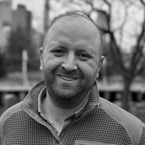
William Farrell
Senior Transportation Engineer, Sam Schwartz
William Farrell is a professional transportation engineer at Sam Schwartz with over ten years of experience in New York City and a strong conviction for social, economic, and environmental justice. He has also held positions as a data journalist for the DC Policy Center and an adjunct professor at The City College of New York.

Thomas Heltzel
Associate Director, One Architecture
Tom Heltzel is a licensed architect and LEED Accredited Professional with over twelve years of experience, with the last six years focused exclusively on work for public entities. Tom collaborates with cities and public clients to develop innovative solutions to resilience infrastructure. He is currently focused on ESCR and BMCR’s flood protection, Bellevue Hospital’s coastal resilience plan, the East River Park Amphitheater, and the Energy and Sustainability Strategy for the FiDi Seaport.

Nicole Payne
Division Chief, Office of Civil Rights Policy & Guidance, FTA
Nicole Payne is a transportation planner working to advance social and economic wellness for systematically marginalized communities through expansion of accessible mobility options. She has experience ranging from wheelchair accessible taxi service to citywide emergency evacuation plans. Nicole currently leads a team at the Federal Transit Administration responsible for developing federal equity and accessibility policies, guidance, and initiatives involving public transit.
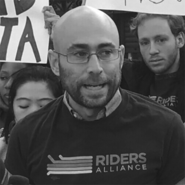
Danny Pearlstein
Policy & Communications Director, Riders Alliance
Danny Pearlstein is Policy & Communications Director at the Riders Alliance, New York’s grassroots organization of subway and bus riders. He started advocating for better public transit in high school and has worked as an urban planner, a City Council staffer, and a lawyer representing injured workers and low-income tenants.

Niharika Shekhawat
Urban Designer, Grimshaw
Niharika Shekhawat is an urban designer who has worked on a range of projects, while mobilizing public engagements that foster powerful agency through design collaborations. She strongly believes in integrating resiliency and activism with design and research, to create healthy, equitable, and resilient cities. She is currently an Urban Designer at Grimshaw working on mass transit and master-planning projects.

Ria Singh
Electrical Engineer, Arup
Ria Singh is an Electrical Engineer at Arup’s New York City office and works as an on-site consultant within the Resilience and Sustainable Design team at the Port Authority of New York and New Jersey. Ria’s work focuses on developing sustainable and resilient energy landscapes to support buildings and critical infrastructure.

Michael Woods
Architect, Perkins & Will
Michael Woods is an architect and filmmaker committed to designing projects that minimize the impact on the environment while honoring the history of the places we live and work. He currently works with Perkins&Will’s New York studio. He has also helped improve the methods that architects use to share knowledge and explain architecture through the use of short films. He has created films and made presentations to the American Institute of Architects conventions and KA Connect. He continues to add sites to his video blog, Eat Drink See Architecture.
1 Center for an Urban Future, An Unhealthy Commute: How Long Travel Times Impact NYC’s Health Care Workers (New York: Center for an Urban Future, 2023), https://nycfuture.org/pdf/CUF_An_Unhealthy_Commute.pdf.
2 The City of New York, A Stronger, More Resilient New York (New York: The City of New York, 2013), https://s-media.nyc.gov/agencies/sirr/SIRR_singles_Lo_res.pdf.
3 Greater Cleveland Regional Transit Authority, HealthLine: About, accessed August 27, 2024, https://www.riderta.com/healthline/about.
4 Metropolis, “TransMilenio Bus Rapid Transit System,” accessed August 27, 2024, https://use.metropolis.org/case-studies/transmilenio-bus-rapid-transit-system#casestudydetail.
5 Sam Schwartz, 14th Street Transit & Truck Priority Pilot Project Quarterly Report, Winter 2020, https://static1.squarespace.com/static/5bc63eb90b77bd20c50c516c/t/5ec421b14abb5b1fa619df9e/1589912002654/14+Street+Report+2+Winter+2020.pdf.