Lucrecia Montemayor contributed to an RPA report examining the threats to the Tri-State area by coastal flooding.
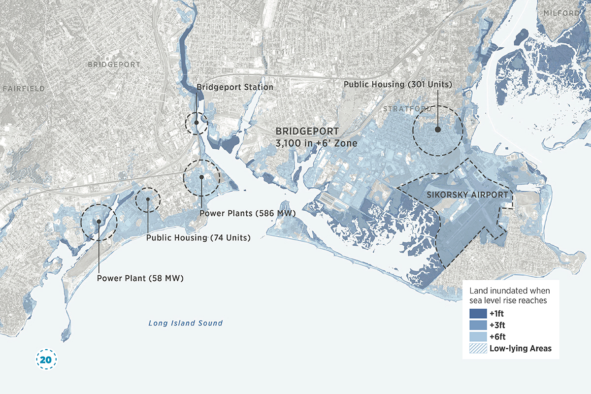
At One Foot:
“Overall, around 60 square miles, where 19,000 people live and 10,000 work, will be under water. But the impacts will initially be neither “immediate nor dramatic”—it will creep up on the residents in New York and surrounding areas.”
At Three Feet:
“By the time the water level rises to this level, the consequences will be plainly visible. Periodic flooding will worsen, and the water will start spreading out, where it will affect subway service, railways, and industrial infrastructure.”
At Six Feet:
“At this point, the coastline would be completely transformed, and what had been a suburban issue will become a “force of destruction in our urban centers,” the report ominously predicts. In total, around 280 square miles will be lost, doing away with 20 percent of the power generating capacity in the region. About 619,000 residents might lose their homes and 362,000, their jobs.”
Read more: Mapping the Inundation of New York City, CityLab
Full Report: Under Water, How Sea-Level Rise Threatens the Tri-State Region, RPA